 GeoData.NZ
RELATIVE HUMIDITY
Type of resources
Topics
Keywords
Contact for the resource
Provided by
Years
Update frequencies
status
-
An automated weather station operates at Cape Adare (-71.30492, 170.23256). The station was established in 2014 and continues to transmit live data. Data are logged every 30 minutes. Parameters: - Air Temperature (C) - Relative Humidity (%) - Solar Radiation (W/m2) - PAR (uE) - Wind Speed (m/s) - Wind Gust (m/s) - Wind Direction (true bearing degrees) GET DATA: adminteam@antarcticanz.govt.nz
-
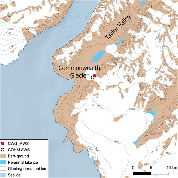
This metadata record represents the code and data used for the first application of WRF-Hydro/Glacier in the McMurdo Dry Valleys (Commonwealth Glacier), which as a fully distributed hydrological model has the capability to resolve the streams from the glaciers to the bare land that surround them. We applied a glacier and hydrology model in the McMurdo Dry Valleys (MDV) to model the start and duration of melt over a summer in this extreme polar desert. To do so, we found it necessary to prevent the drainage of melt into ice and optimize the albedo scheme. We show that simulating albedo (for the first time in the MDV) is critical to modelling the feedbacks of albedo, snowfall and melt in the region. This is a first step towards more complex spatial modelling of melt and streamflow. The Zenodo data includes output point data (*.csv) and namelist used in: Pletzer, T., Conway, J.P., Cullen, N.J., Eidhammer, T., & Katurji, M. (2024). The application and modification of WRF-Hydro/Glacier to a cold-based Antarctic glacier. *Hydrology and Earth System Sciences*, 28(3), 459-478. https://doi.org/10.5194/hess-28-459-2024 The modifications to the WRF-Hydro/Glacier model used in the paper can be found on GitHub: https://github.com/tpletzer/wrf_hydro_nwm_coldglacier GET DATA: https://doi.org/10.5281/zenodo.10565032
-
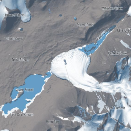
This metadata record represents meteorological data and in situ and isotopic measurements of the isotopic ratio of water vapor from the ablating ice from two lakes in the McMurdo Dry Valleys, Antarctica. Lake ice and water samples (from the surface water and at depth via SCUBA) were collected in vials. Ice samples at Lake Bonney were collected daily, and at Lake Fryxell samples were collected approximately twice per day. Lake ice samples were also collected at Lake Fryxell along three transects spaced approximately every 300 to 500 m (meters) across the lake surface. Water vapor isotope flux measurements were collected via air inlets which were installed at 0.5, 1.0, and 3.0 m on the tower using ¼″ OD Teflon tubes. The lines were insulated and continuously pumped at a flow rate of approximately 10 L min−1 using a secondary pump. Meteorological measurements with a Vaisala HMP100 probe for temperature and relative humidity readings and an RM Young wind vane (model 05108) for wind velocity measurements, at heights of 3.0 and 0.5 m. Air temperature, relative humidity, wind velocity, and lake surface temperature measurements were recorded every minute via a Campbell Scientific CR1000 data logger. Spatial Coordinates: Lake Bonney (-77.60672778, 162.44982222) Lake Fryxell (-77.60672778, 163.12508611) Further details are provided at: A. W. Bellagamba, M. Berkelhammer, L. Winslow, P. T. Doran, K. F. Myers, S. Devlin & I. Hawes (2021) The magnitude and climate sensitivity of isotopic fractionation from ablation of Antarctic Dry Valley lakes, Arctic, Antarctic, and Alpine Research, 53:1, 352-371, https://doi.org/10.1080/15230430.2021.2001899 GET DATA: https://uofi.app.box.com/s/6vakvltbsn1nhrpzudffclrn5iufpoux/folder/88268262341
-
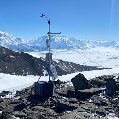
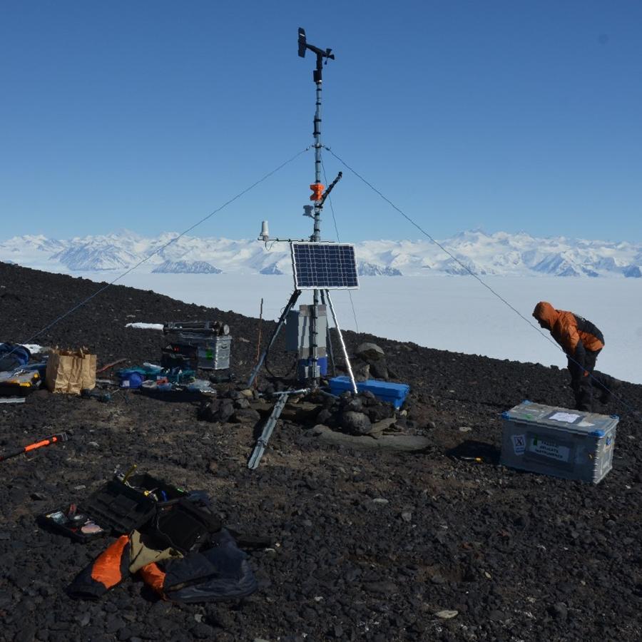
Automated weather stations were installed to measure local scale weather conditions at Miers Valley, Miers Ridge, Commonwealth Glacier, Cape Christie, and Haystack Mountain. Miers Valley, Miers Ridge and Haystack Mountain stations have been operating since early 2021, Haystack, Commonwealth Glacier and Cape Christie were installed in December 2021, 2022, and 2023, respectively. Data are available on request in NetCDF. Parameters: - average air temperature (C) - average relative humidity (%) - average short wave in (W/m2) - average pressure (hPa) - wind speed (ms-1) - wind direction (true bearing degrees) - wind standard deviation Coordinates: - Miers Valley (-78.09805, 163.794283) - Miers Ridge (-78.123205, 163.863319) - Commonwealth Glacier (-77.563987, 163.281064) - Cape Christie (-72.29722222, 169.9847222) - Haystack Mountain (-77.05, 162.585) GET DATA: marwan.katurji@canterbury.ac.nz